
Roman Liubun
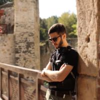
Roman Liubun
Freelancer, Masaryk University
Country
Ukraine
Member since
Bio
I’m an archaeologist, GIS analyst, and 3D modeler specializing in the use of digital technologies in field archaeology. I studied at the Departments of Archaeology in Bratislava and Nitra (Slovakia), where I focused on landscape archaeology and spatial analysis.
In my work, I combine traditional archaeological methods with modern tools such as photogrammetry, LIDAR scanning, drone-based aerial photography, 3D modeling, and GIS. My field experience spans Ukraine, Slovakia, and the Czech Republic, with a research focus on fortified settlements, ritual sites, and burial mounds. I’m also engaged in 3D documentation of cultural heritage sites, archaeological sites, and museum spaces.
Until May 2025, I worked as a GIS specialist at the Archaeological Centre Olomouc, where I took part in archaeological site survey projects using LIDAR scanning. I am currently pursuing a PhD in archaeology and working as a freelancer on both academic and independent research and commercial projects.
My mission is to make archaeology accessible and relevant in today’s world — bringing the stories of our past and its material legacy into an interactive, open, and digital space.
Topics of interest
Open for research collaboration in the following topics
Available for work in open-air museums or at cultural heritage events with demonstration skills in
Happy to mentor and share my experience in the following skills
Looking for collaborators to help with my research in the following topic
.")
.")